WIO Symphony – a tool for ecosystem-based marine spatial planning
WIO Symphony is a web tool that supports marine spatial planning in the Western Indian Ocean by assessing environmental impact from human activities. We developed the tool together, the Nairobi Convention, its ten member states, and a Swedish team.
Follow our work
Official webpage: www.nairobiconvention.org/wio-symphony
To get
- updates
- code and data
- discussions and contacts
... visit GitHub
Show, calculate, compare
The WIO Symphony web tool supports your marine spatial planning by assessing environmental impact from human activities. WIO Symphony lets you visualize data, test scenarios, and compare different ways of using the ocean.
- Show data
- Create maps
- Calculate cumulative impact on environment
- Compare planning options
The user interface gives you control of your work
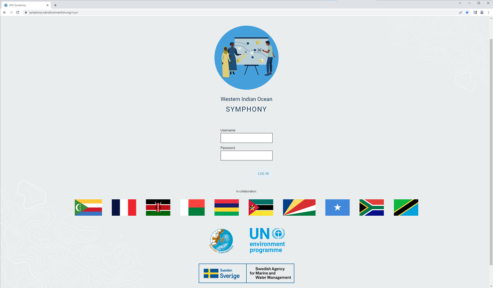
Login via the WIO Symphony page at the Nairobi Convention, if you have a login. See www.nairobiconvention.org/wio-symphony
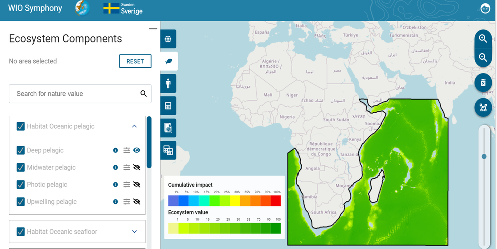
View the data layers, such as maps of ecosystem components.
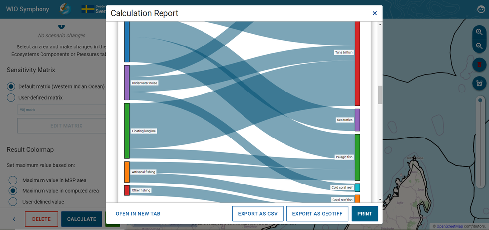
Use the diagram in the calculation report to see what is impacting what.
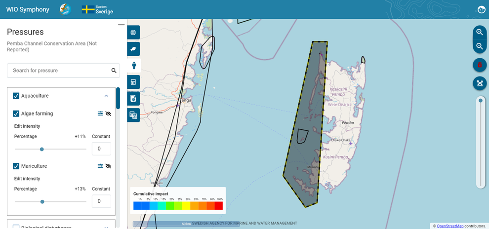
Draw your own areas, and edit pressures to test various scenarios of future use.
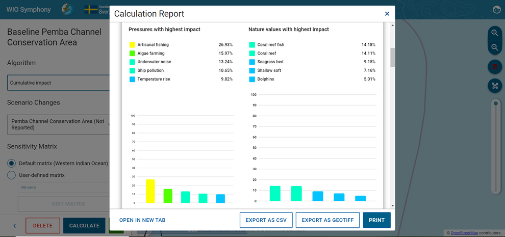
The diagram shows you the top 5 impacts, in the calculation report.
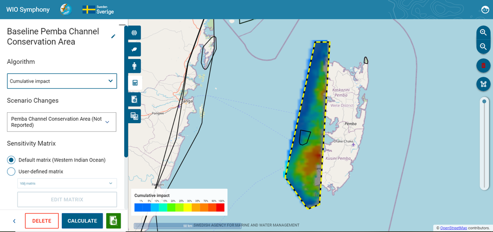
Cumulative impact is shown as heat maps, too.
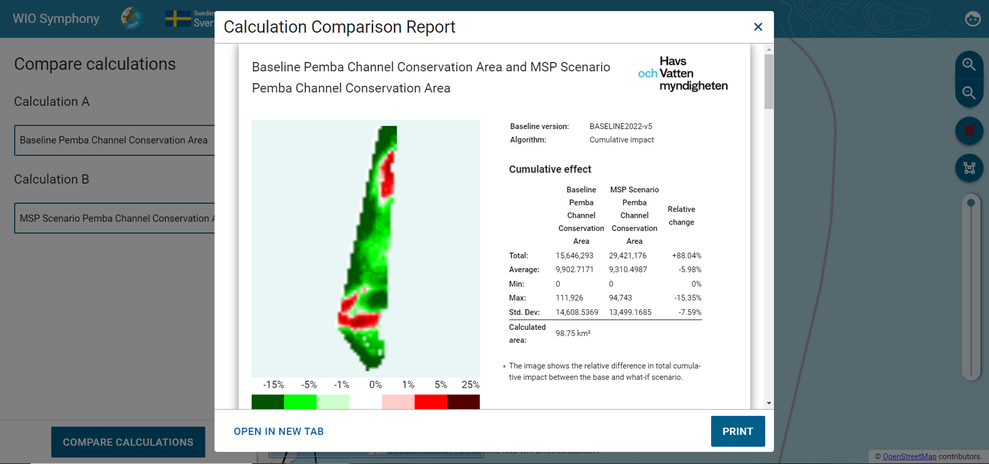
Compare two scenarios with the comparison report.
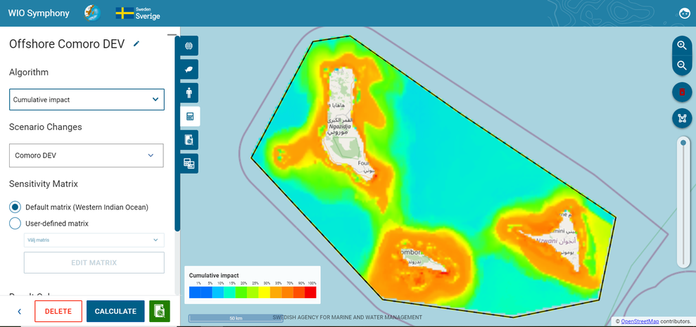
Find best areas for an ocean use from a cumulative environmental impact perspective.
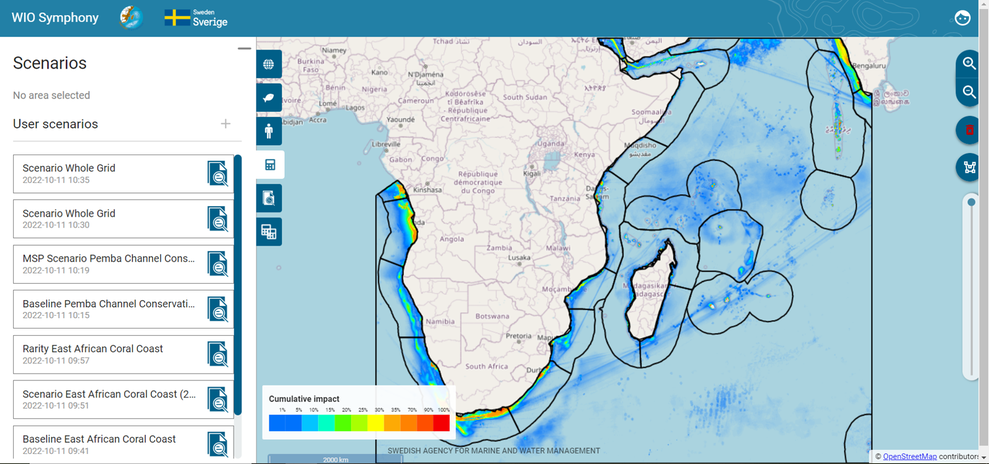
Work on various geographical scales, view data and impacts.
How WIO Symphony works

The WIO Symphony web tool supports your marine spatial planning by assessing environmental impact from human activities. Pressures, ecosystems and sensitivity are combined into cumulative environmental impact. Click to enlarge.
WIO Symphony is based on over 80 maps of ecology and human activity. The tool combines pressures, ecosystems and sensitivity into cumulative environmental impact.
The results are presented as heat maps, which makes it easy to identify areas of high and low cumulative impact. They are also presented as tables and diagrams showing details for any given area.
A similar tool was developed and used in Swedish marine spatial planning:
Developed for the Western Indian Ocean
The WIO Symphony project is a collaboration between the Nairobi Convention, its ten member states in East Africa, and a team of Swedish institutions lead by the Swedish Agency for Marine and Water Management.
We co-develop the WIO Symphony tool for the Western Indian Ocean togheter wiht a wide range of experts from the region and beyond.
The tool is hosted in the region, available to practitioners there.
The partnership
The Nairobi Convention secretariat - ensures regional representation and links to policy
The ten member states
- Somalia
- Kenya
- Tanzania
- Mozambique
- South Africa
- Comoros
- Madagascar
- Seychelles
- Mauritius
- Réunion, France
Each state has a representative in the technical working group to tailor WIO Symphony to their user needs.
Swedish Agency for Marine and Water Management (SwAM) - leads the Swedish team
Geological Survey of Sweden (SGU) - contributes with expert knowledge on marine geology, as well as technical and analytical expertise
Swedish University of Agricultural Sciences (SLU) -collects and processes relevant data
University of Gothenburg (GU) - provides expert knowledge on deep sea ecology and oceanography
We consult additional experts from universities, institutions, and governments along the way.
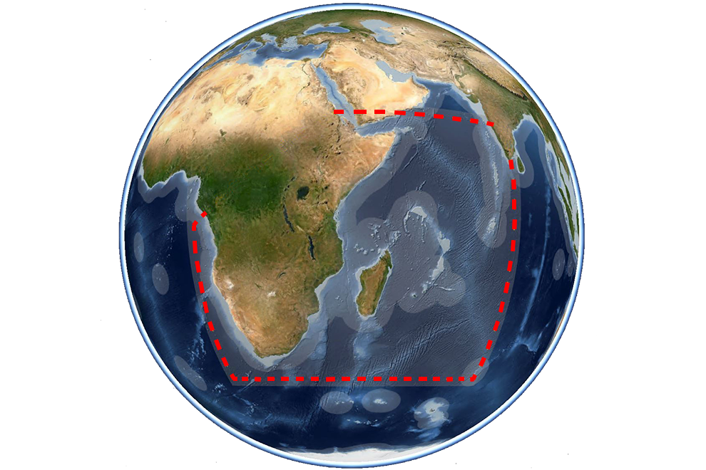
The WIO Symphony tool for the Western Indian Ocean covers 9 percent of the world ocean. The WIO Symphony project is a collaboration between the Nairobi Convention, its ten member states in East Africa and a Swedish team.
Hear partners and stakeholders about the significance of the WIO Symphony tool for achieving a sustainable blue economy in the Western Indian Ocean region. Watch video on YouTube.
Data contributors
The development of WIO Symphony was possible also thanks to all data contributors – thank you!
See the list at www.nairobiconvention.org/wio-symphony.
Official webpage
Visit WIO Symphony´s official home at the Nairobi Convention www.nairobiconvention.org/wio-symphony.
Timeline
Visit our Info channel on GitHub to get latest updates and events.
2022
- Thematic Group work
- Technical Training on spatial modelling GIS, R
- Deadline data contribution – in May
- Review and evaluate maps, revisit sensitivity scores
- Transfer software tool from Sweden to Western Indian Ocean
- Launch event at WIOMSA Symposium
- Operational test
2023
- Launch and hand-over to Nairobi Convention
- Country-based training of users
- WIO Symphony in full operation for marine spatial planning
Share and contribute
- Use our fact sheet
 Pdf, 636.3 kB.
 - Share our web address: www.havochvatten.se/wio-symphony
- Contribute data or expertise
- Go to our official webpage at the Nairobi Convention www.nairobiconvention.org/wio-symphony

This work is part of our SwAM Ocean, our development cooperation programme and our bilateral cooperation.
Contact
WIO Symphony
Email WIO Symphony
Wilhelm Gårdmark
Senior analyst
International Affairs
Tel: +46 (0)10-698 61 47
Ingela Isaksson
Senior analyst
International Affairs
Tel: +46 (0)10-698 62 29

