Swedish marine spatial planning

Marine spatial plans provide guidance on what is the most suitable use of the sea from a holistic perspective. The plans guide national authorities, regions, municipalities and courts in future decisions, planning and licensing processes.

The purpose of the marine spatial plans is to contribute to long-term sustainable development. They integrate economic, social and environmental objectives.

The marine spatial plans will contribute to

  • good environmental status in the marine environment is reached and maintained
  • marine resources are used sustainably so that maritime industries can develop
  • co-existence is promoted between different activities and uses

An ecosystem approach should be applied in the work to develop proposals for marine spatial plans.

In Sweden, national marine spatial planning is regulated in the Chapter 4, Section 10, and in the Marine Spatial Planning Ordinance (2015:400). In this way, Sweden has incorporated the EU Framework Directive on maritime planning (2014/89/EU) into national legislation.

Map showing Sweden's three marine spatial planning areas.

Sweden’s three marine planning areas.

Sweden has three marine spatial plans

  • one for the Gulf of Bothnia
  • one for the Baltic Sea
  • one for the Skagerrak/Kattegat

The marine spatial plans include Sweden’s Economic Zone and the areas that are not included in properties in Swedish territorial seas from a nautical mile outside the baseline referred to in the Swedish Sea Territory and Maritime Zones Act (2017:1272).

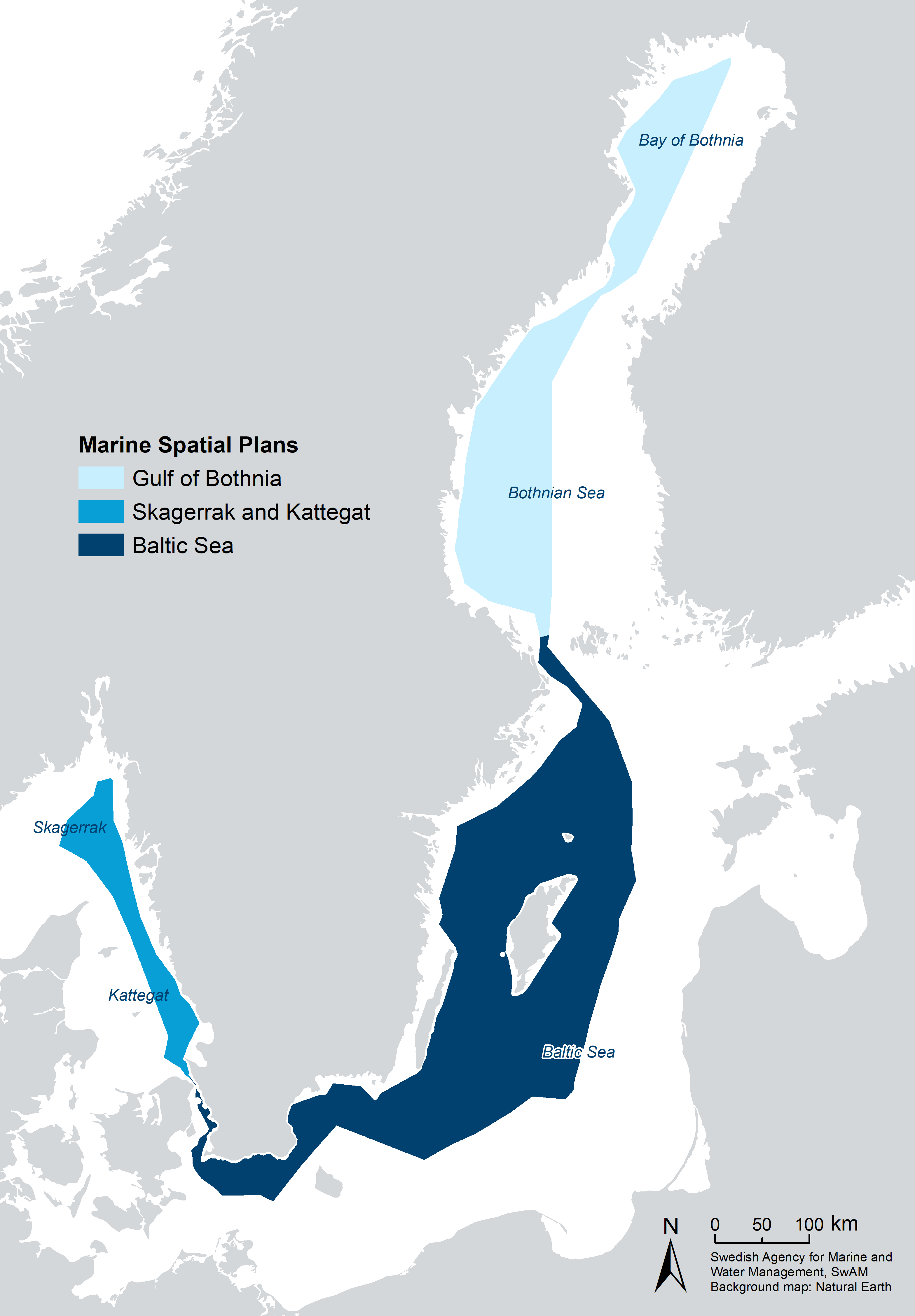
The Swedish Agency for Marine and Water Management is responsible for drafting plan proposals. The Government adopts the plans and may also issue regulations on such prohibitions or restrictions on activities and measures in an area covered by a marine spatial plan as needed to achieve the purpose of the plan.

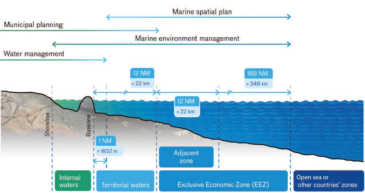
According to the Planning and Building Act (2010:900), municipalities and certain regions have planning responsibility for Sweden’s territory, which also includes internal water and territorial seas. This means that there is an overlap between national marine spatial planning and planning in accordance with the Planning and Building Act in part of the territorial sea.

The sea and its use are managed through various types of regulations and measures where marine spatial planning is one of several tools .

In the territorial sea, the state shares planning responsibilities with the municipalities. In the economic zone, the state has sole responsibility for planning. The sea and its use are also managed through, for example, water management and marine management.

Terms, boundaries and planning responsibilities.